Our last day was a marathon road trip. We headed south west from Medora to the geographic center of the US, veered into Wyoming to see Devil's Tower, zipped by Sturgis, the mega-motorcycle-rally location, and Spearfish to return to Rapid City for our final night.
As always, we had videos, drawings, and other amusements to pass the time. We never got bored on this trip.
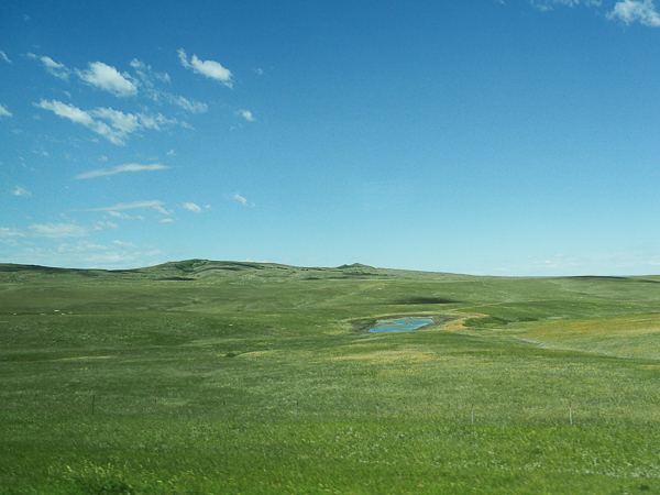
Montana may have grabbed the slogan "Big Sky Country," but neighboring North Dakota has its share of big sky.
We had blue skies after the severe weather of the day before.
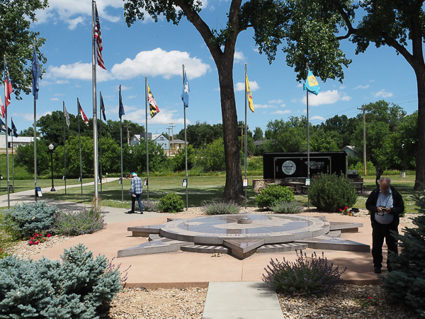
Belle Fourche (pronounced FOOSH), SD, is the ceremonial geographic center of the US. This isn't the actual center, which is about 20 miles away on private land, but it is close enough. Besides it is a lovely park where we ate our box lunches.
The geographic center changed as the country added states. Before Hawaii and Alaska were admitted, the center was more to the southeast near Lebanon, Kansas. That remains the center of the contiguous 48 states.
A "geographic center" is an interesting notion, but it is inherently imprecise. Different ways of determining it, changes in shorelines, and such like all have an effect.
Nevertheless this spot will serve. At least until Puerto Rico is finally admitted as a state. I wonder how much that would change it? According to a handout at the site, Hawaii's admission only shifted it six miles. I doubt Puerto Rico would make much more of a difference.
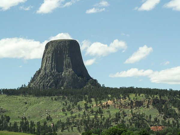
This wasn't our first sight of Devils Tower, but it was the first decent picture I got. It shows how the tower rises abruptly out of the surrounding landscape.
A common Native American designation of the feature is Bear's Lodge. The story was that a bear pursued children playing in the area. They climbed the tower and the bear scratched the rocks into this distinctive pattern while trying to reach its prey.
A mistranslation by an interpreter led to the designation as Devil's Tower. Local tribes have made unsuccessful attempts to get it officially changed back. The tower is sacred to all of the local tribes.
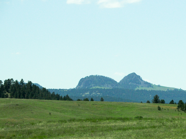
Not far from Devil's Tower is another feature called Bear Butte. It also is sacred to the Native Americans. It is supposed to resemble a bear sleeping on its back (not so much from this angle). Perhaps the same bear who was foiled at Devil's Tower needed to rest from his exertions?
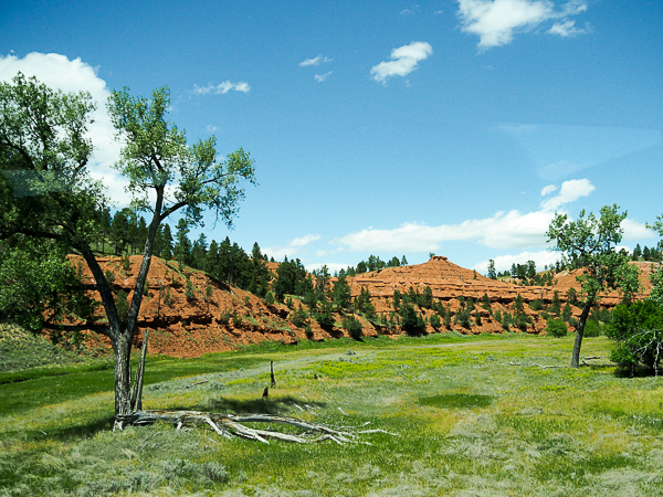
As we near the tower, we cross the Belle Fourche River winding below the red sandstone bluffs of the Spearfish Formation. They are the oldest rocks visible in the area. Newer layers have eroded away.
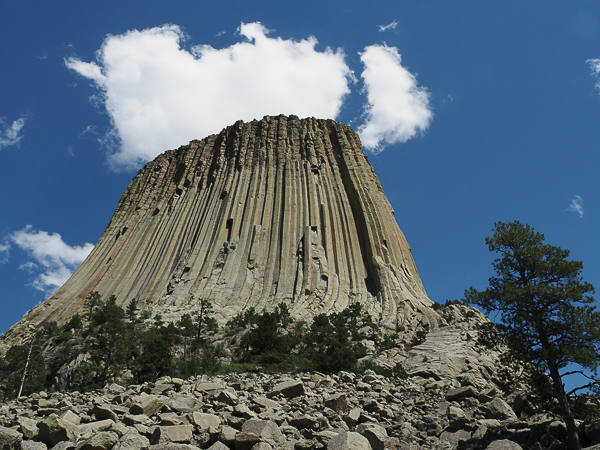
A closer-up view shows the basalt columns. Although these can be found elsewhere in the world, the Giants' Causeway in Ireland and Staffa in Scotland being two notable examples, the columns here are larger than elsewhere.
There are several scientific formation theories, not to be confused with the rampaging bear. The only thing they agree on is that 50 million years ago, the surface of the earth was more-or-less 1-2 MILES above the current top of the tower. In the intervening millennia, the land has been eroded away.
Erosion continues. The effects of more recent erosion can be seen in the rocks at the foot of the tower, which are fallen basalt columns, and the weathered area at the top, which has been exposed to the elements much longer than the smoother lower levels.
At Mt. Rushmore the rocks at the bottom of the monument were from blasting. This rubble has occurred naturally.
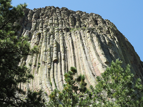
There is a paved walking trail circling the tower that was partially closed due to the severe weather of the day before. Many trees were down, but at least we could get this far.
It won't be visible in this resolution, but running along one of the cracks in the middle of the image are the remains of a wooden ladder used for the first ascent of the tower in 1893.
Inevitably, rock climbers made more technical climbs. The first one was in 1937. Nowadays climbers can apply for permits. Native tribes believe that these climbs are desecrations of the sacred space. A compromise has been reached that discourages climbs during June, a time of enhanced spiritual observance at the site.
There were numerous prayer bags and cloths here and there around the tower. I didn't take any pictures of them.
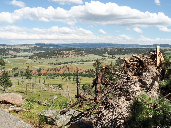
A viewpoint close to where I took the above picture looks out over the surrounding countryside. The broken trees are relics of the previous day's storm damage.
When you think of how deeply the top of the tower was buried millennia ago, it's mind-boggling how much deeper the surrounding countryside must have been covered.
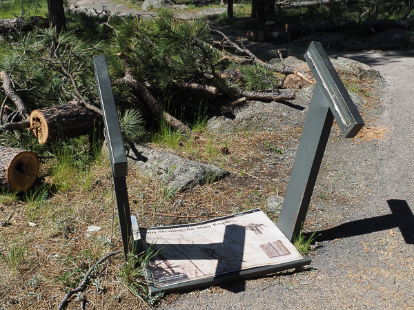
One of the interpretive signs also fell victim to the storm.
Most of the debris had been cleared from the path up to this point, but at least one-third of the path around the tower was still closed.
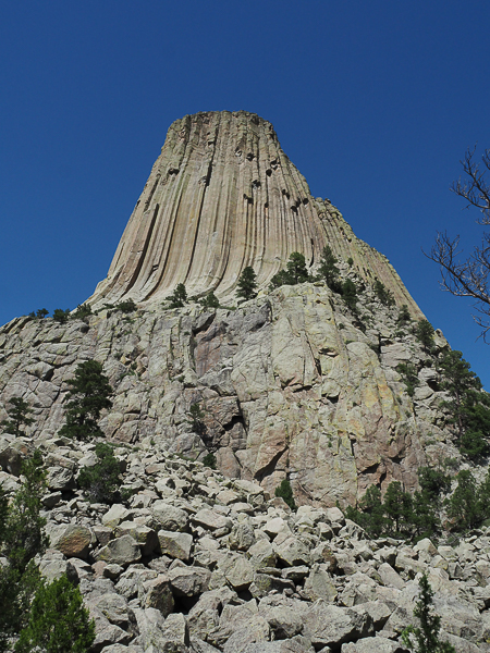
On the way back to the visitors' center, the outlook on the tower continued to change. The basalt columns rest on even older rock.
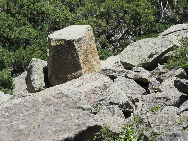
This was the only spot where I saw a rock that clearly came from one of the columns. Typically such columns are five or six sided. Those here are more irregular although no one know why. Perhaps because they are larger.
None of the rocks have fallen in recorded history. I don't want to be around when one does.

There were a number of wildflowers here and there.
One of the most common was (I believe) spreading dogbane. It is found in most states and is toxic to humans and other critters.
There were others but my camera's focus kept getting confused, so this is the only picture.
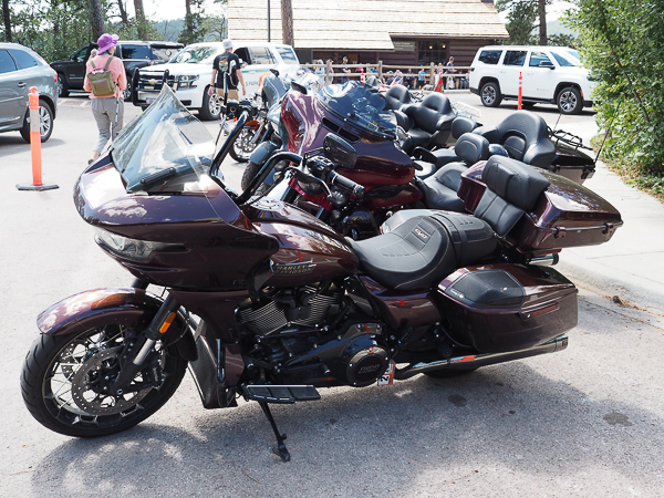
Every year since 1938 (except for the WWII years), there has been an annual motorcycle rally in Sturgis, SD. Jim's sister Grace headed to the area a few times when she was participating in a motorcycle club, but she reports that they spent more time touring the Black Hills than hanging out in Sturgis. They also visited Devils Tower.
Although the rally is in August, these riders were beating the crowd.

This tag holder from our neighboring West Virginia caught my eye.
One of our travelers was a motorcycle enthusiast and he told me it's a thing.
Looking online, yes it's a thing. There are various listed rides with participation levels including silver, gold, platinum, and insanity! Some are completely outrageous such as 48 states in 10 days. Insanity indeed!
The only way to become a member of the association is to complete one of the rides (shortest is 1000 miles in 24 hours). Documentation is required and reckless riding is not permitted.
Well, there are horseback distance races of 100 miles in 24 hours (with mandated breaks to rest the horse). And the Mongol Derby, 1000 miles in 10 days. I've known people who have competed in all of these. There's all sorts of craziness in this world.
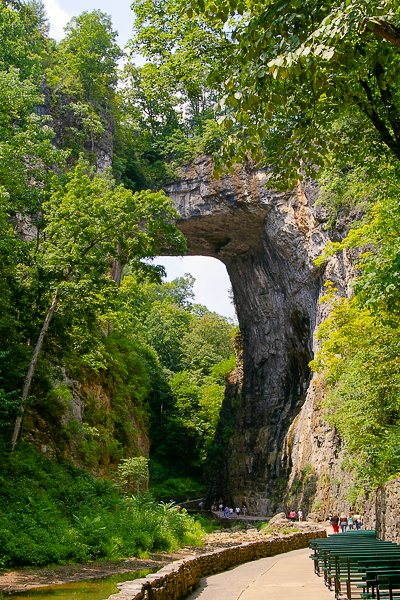
One of the ice breakers asked us to name the one thing we would take people to in our hometown. Since I always like to end my travelogues with a picture from home, here we are.
I suggested Natural Bridge State Park, pictured here.
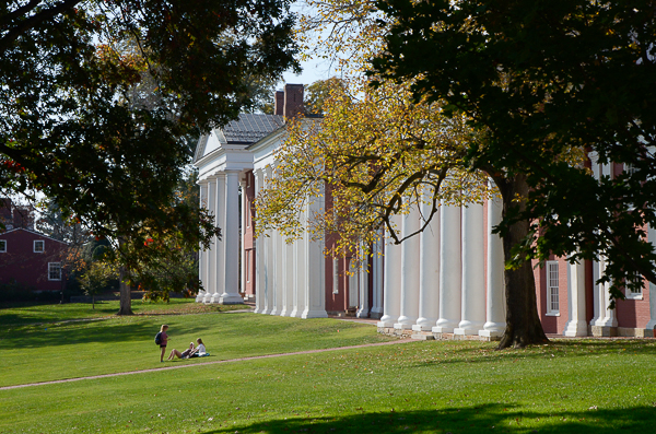
Jim chose Washington & Lee University.
It was a fabulous trip, but as usual, we were glad to get home.
Click your "back" button to return to the previous page or click for our picture album/.