The Kingdom of Dál Riata encompassed the areas we would be visiting over the next two days: Northern Ireland & the Inner Hebrides islands of Islay, Staffa & Iona. Its origin is shrouded in legend.
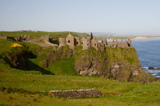
On our way from Portrush, where we had disembarked from the ship, to the Giant's Causeway, we passed the ruins of Dunluce Castle. Even after the eclipse of Dal Riata, northern Ireland and Western Scotland were closely associated with various overlords claiming territories on both sides of the North Channel.
I have found numerous online claims that these ruins were the inspiration for Cair Paravel in C.S. Lewis' Narnia tales. Lewis was born in Belfast and spent his childhood in Ulster.
Shortly after our castle photo op, we proceeded to the Giant's Causeway. Although there is a shuttle bus, I found the hike down to be a great way to stretch my legs.
The (usually) 6-8 sided columns are similar to columns found on Staffa in the Inner Hebrides and have given rise to the legend of Finn MacCool, also known as Fingal, and his conflict with a Scottish giant. The two were said to have built a causeway of columns connecting Ireland and the Scottish island of Staffa. In fact, according to our geologist, the columnar formations are not contiguous and were not created at the same time. Well, truth is stranger than fiction anyway.
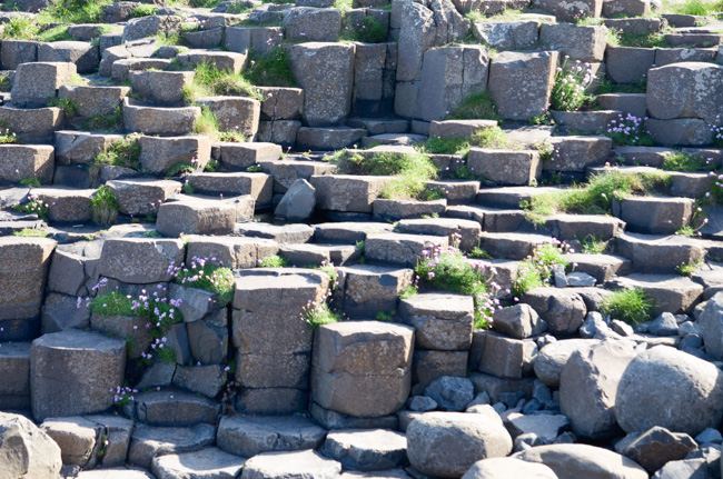
In areas where the columns were dry, walking was easy, but there were crowds. In areas where the columns were wet with sea spray, I found walking to be treacherous.
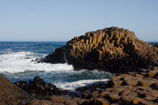
Caught between the crowds and uncertain footing, I decided to make tracks to the adjacent headland. The intervening bay is called Port Noffer.
The rocks there may not be as famous as the ones I was leaving, but they were more varied.
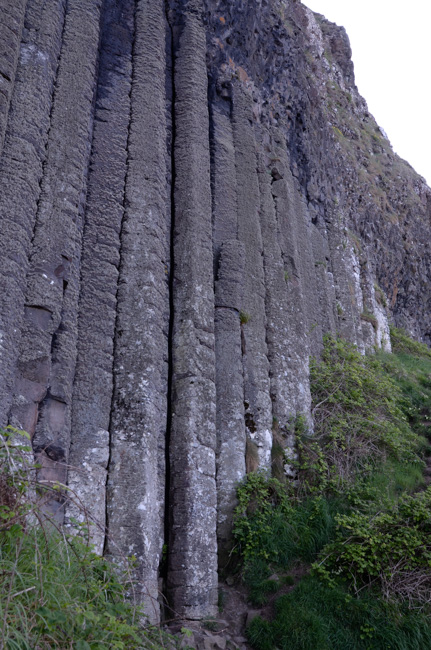
As I walked up the path on the cliff across the bay, I came on this formation, which is called "The Organ" because of its resemblance to organ pipes.
There was once a link describing the geology of the area beyond the "causeway," but it has vanished. Smithsonian Magazine discusses how the basalt columns are formed. It takes a particular combination of molten rock and sea water. I regretted not having Tom Sharpe, our expedition geologist, along for this walk because there was much that was puzzling.
Although this rocky area seems static, it is an evolving landscape with areas of instability.
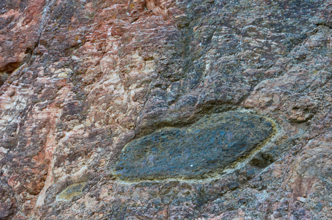
This formation at the terminus of the headland is similar to configurations that locals call "Giant's eyes."
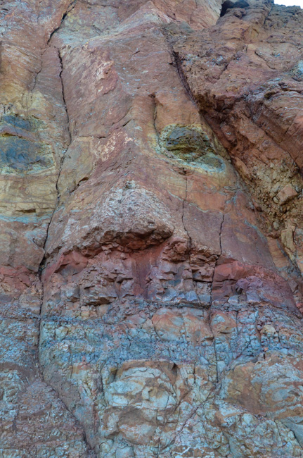
This nearby colorful configuration suggests the Easter Island moai statues. This one is winking at me!
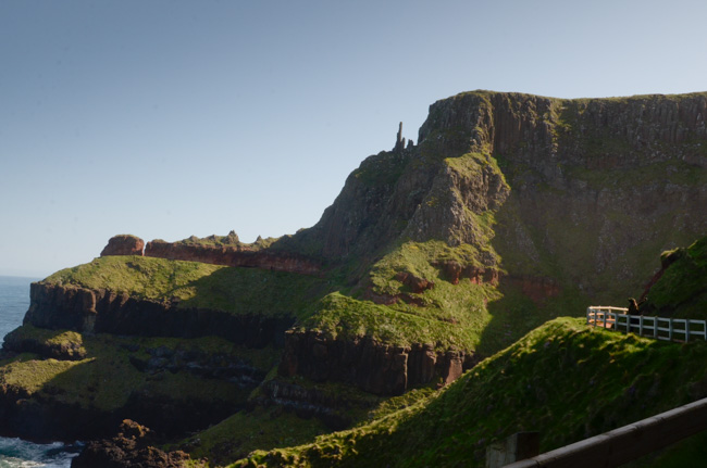
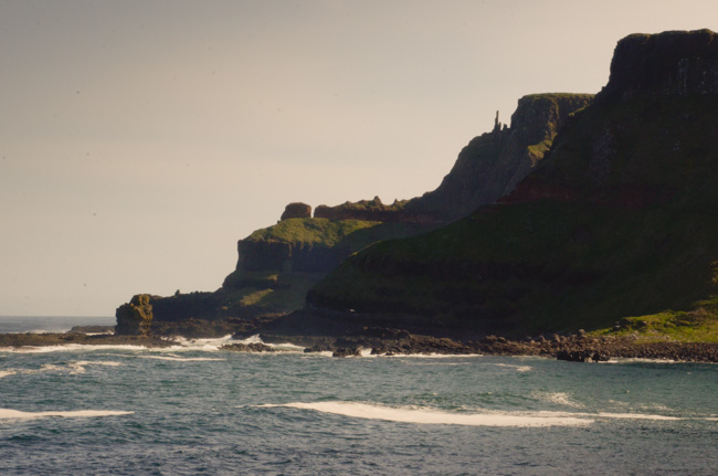
The bay past the edge of the headland is called The Amphitheatre. Management closed the path in 1994 due to slope instability. There were enough serious slumps affecting the path I had already navigated that I was not tempted to go farther.
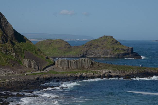
Looking back at the "causeway" proper. This place reminded me of Petra in that most people go only as far as the locations, the Treasury in Petra's case, that they have seen in travel brochures (or movies). As spectacular as they may be, there is much more in both places.
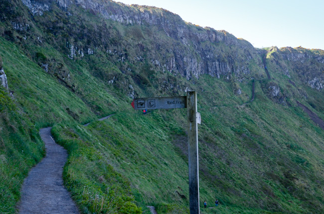
After checking my watch I realized that I needed to return to the bus. The path divided and I elected to take the "high road" up the cliff rather than retrace my steps.
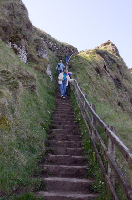
I have not been able to find why these were called the "shepherds' steps." The implication, that shepherds would drive sheep either up or down this path, is daunting.
From what I've seen on the WWW, there are a mere 167 steps -- with a handrail. It puts the climb up to Skellig Michael into perspective.
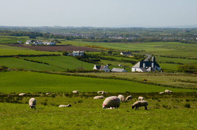
The views inland from the upper path give no indication that the sea is only a few hundred yards away -- vertically and horizontally!
This was our last stop in Ireland. Our next port of call would be Scotland.
Click your "back" button to return to the previous page or click for our picture album.