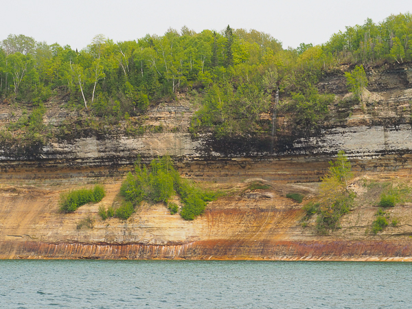
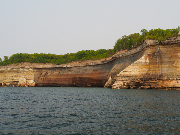
The pictured rocks coast was an unexpected bonus. Stunning natural colors occur when groundwater oozes out of cracks and trickles down the rock face. Iron (red and orange), copper (blue and green), manganese (brown and black), and limonite (white) are among the most common color-producing minerals. We saw them in the late afternoon, which would have been a good time, but the smoky haze flattened the light.
Picking which of the many pictures I took was difficult. I wanted to show the variety of shapes and colors.
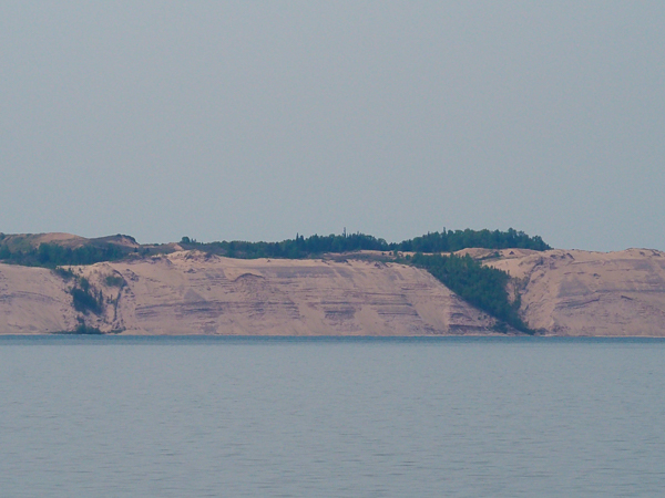
On the way to Munising where we would board our tour boat, we passed the 300' high Grand Sable sand bank on the eastern of the Painted Rocks National Lakeshore. Five square miles of dunes are protected.
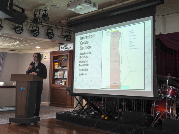
On the way our LakeLorian Ian gave a presentation on the creation of Lake Superior and a review of the geologic features of what we would be seeing.
More information that you probably want to know about the geology can be found at the link.
The vendor for the local tour is Pictured Rocks Cruises.
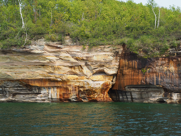
The rocky ground doesn't absorb water well, so the waterfalls are ephemeral. We didn't see many and most of the ones we did see were mere trickles like this one.
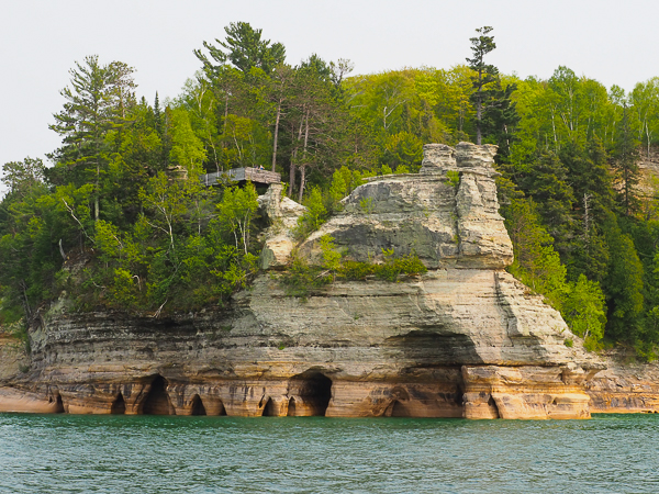
Viewing the scenery from a boat may be the best way to see it, but all along the shore we saw people who had come from the land. The viewing platform (left of center) looks over a pinnacle with a single tree.
Violent Lake Superior storms have sculpted the rock into arches, free-standing stacks, and caves. The lake near the cliff is treacherous. This stretch is infamous as the shipwreck coast. Some storm pictures can be seen at the link as well as a video describing some of the wrecks that can still be seen on the beach or underwater.
Scuba diving on the wrecks is a popular pastime with special guides and outfitters, such as Shipwreck Explorers, which focuses on Lake Michigan, and others.
This sweeping bay shows evidence of multiple small waterfalls, although only one is actively flowing. It is called, wait for it, Bridal Veil Fall.
Harder Au Train formation rock caps the cliff.
The rock looks like a contemplative person. Or a sphinx.

We passed numerous beaches. They were all about as crowded as this one. A road leads through the park giving access to them.
The water may be too cold for swimming, but the sun was warm.
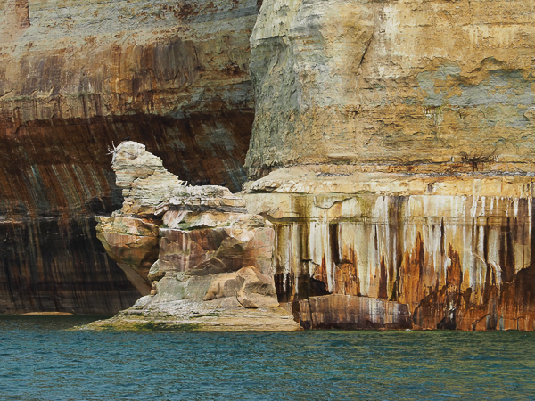
In some places there was a dramatic discontinuity in the rock.
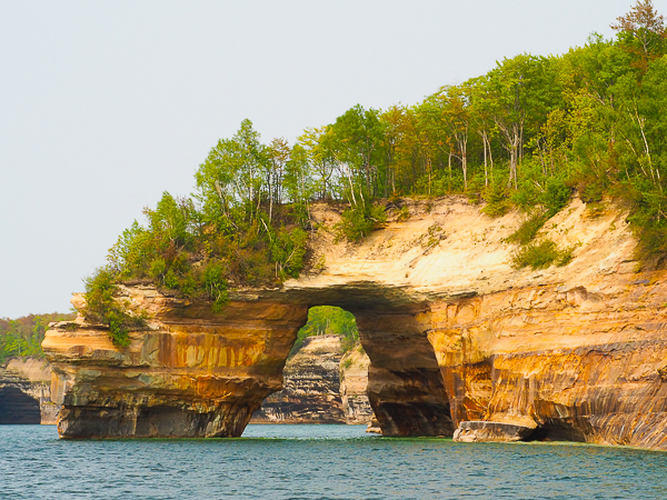
This was the most dramatic of the arches that we saw.
It looks tempting to try to paddle through the arch, but the water is quite shallow underneath it.
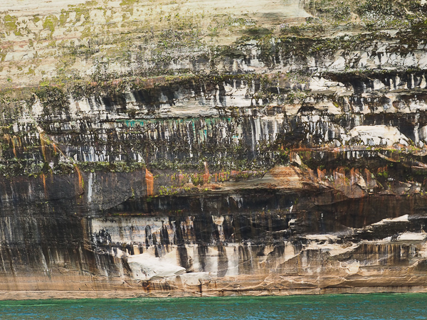
This was the only place I was able to capture all the colors: red (iron), blue (copper), black (manganese), and white (limonite).
Green mosses and lichens add to the texture.

These young men seem to be marveling at reaching the top of the cliff.

This tree is tenaciously clinging to the side of the cliff. We will see other trees that have made extreme adaptations to the situation.
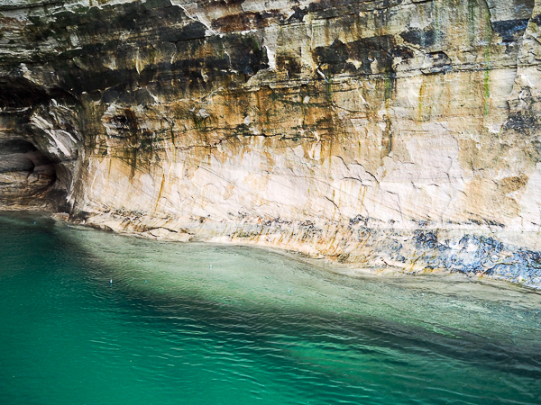
At one point there was a split in the cliff wide and deep enough to let our boat pull all the way in. The clarity of the water is evident.
Lake Superior, because of its size, escaped many of the pollution problems of the other lakes so the water has remained crystalline. Ironically the zebra mussels that have caused so many problems elsewhere, have done a fine job in filtering the water, but it comes at a cost.

This is the only waterfall we saw that had a significant flow. I believe it is Eliot Falls, but none of the online pictures were taken from a boat, so the perspective is different.
It's in an area that has more soil and vegetation to absorb water and produce a sustained runoff.

The formation on the right is called Chapel Rock. At one time an arch connected it to the mainland, but it collapsed in the 1940s. The tree, which is much older, has retained a lifeline of nourishing roots from the pinnacle.
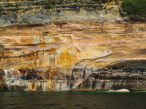
The geologic layers can be clearly seen in this rock face.

As we return to port, we passed this wooden lighthouse outside the Munising harbor. It is called the Grand Island East Channel Lighthouse and was built in 1868. It was decommissioned in 1908 and remained derelict until 2002 when it was stabilized and partially restored.
As noted above our stop in Munising to see the Pictured Rocks was an unexpected and very welcome bonus.
Click your "back" button to return to the previous page or click for our picture album.