After our visit to the capital we headed north to visit the Oahe Dam. This is one of a series six of hydro-electric and flood control dams constructed along the Missouri River. Lake Oahe is the fourth-largest man-made reservoir in the US, after Lake Mead in Arizona, Lake Powell in California, and Lake Sakakawea in North Dakota. It extends almost as far as Bismarck, ND.
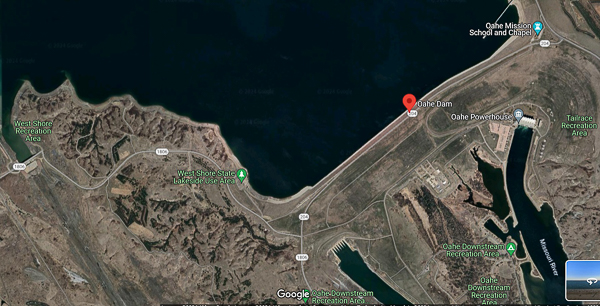
I captured this image from Google Earth to show the size of the dam complex. In a word: huge.
The length of the earthen dam itself is almost two miles. The power house is to the middle-right of the image. Its intake structure is visible as a line at the upper-right of the image.
An outlet structure near the middle of the image releases water that doesn't flow through the power plant.
The emergency spillway is at the far left of the image. It has never been used.
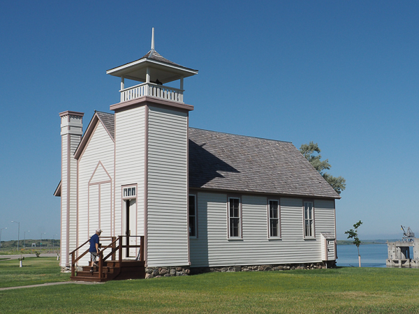
But first, there was much more to this stop than the dam itself. The name Oahe comes from the Oahe Mission. This chapel and schoolhouse was part of that mission to the Dakota people starting in 1884. It was originally located about five miles from here in an area now under water. (The lake created by the dam flooded much of the most productive land owned by the Native peoples. Controversy continues.)
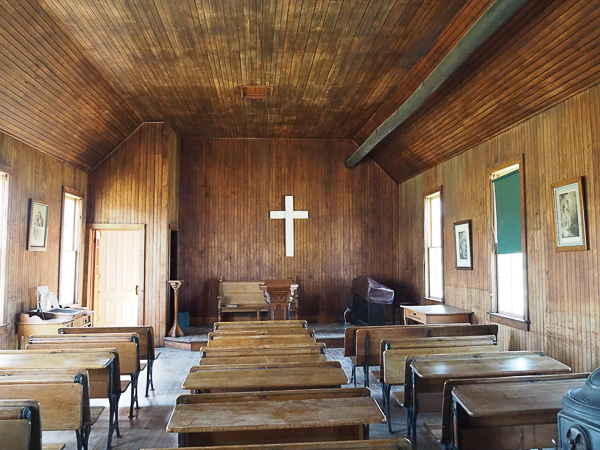
The interior of the building has been restored to its 1907 appearance. Except for the electric keyboard, the furnishings are original. A blackboard has been preserved with writing from one of the last teachers.
The chapel may be rented for events such as weddings.
The place was heated by a single wood-burning parlor stove from the Thomas White Stove Company of Quincy, Illinois. Must have been pretty toasty next to the stove and pretty frigid away from it.
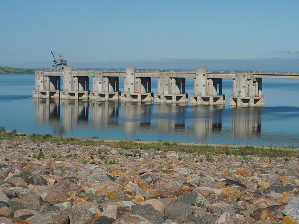
The power plant intakes are just offshore from the chapel.
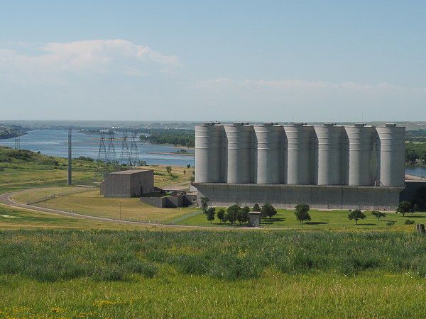
We weren't allowed to take any pictures during the tour of the power house, which is too bad because there was a nifty lighted display showing the six dams on the Missouri and their interaction (click on the "+" beside the "Missouri River Dams" item). Besides pictures help me remember things and there was a lot to remember in the presentation.
The towers are surge tanks that act as "shock absorbers" to prevent problems when turbines are powered up or down. If you have ever experienced water hammer in household plumbing, you can imagine what the shock might be for something on this scale.
The power house contains seven turbines. At the time we visited only three were generating and one was running as a motor. All of the turbines can be configured as either motors or generators, but my memory of the details is hazy. A "motor" can be used to spin up an idle "generator" so that it can be brought online with less impact to the system. If that makes sense. Unfortunately I can't find an explanation online.
After our visit to the dam we were scheduled to travel to Gettysburg, SD, for a picnic lunch in a park there. But as the poet says, "The best laid schemes o' Mice an' Men gang aft agley."
At the dam, one of our tires picked up a bodacious, tenacious chunk of tar. Whenever Mick got over 30mph or so, the bus began to shake itself to bits. He pulled over and spent over half an hour prizing great gobs of goo off the tire. Since our schedule was tight, we enjoyed our picnic on the bus while he labored.
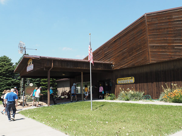
Gettysburg was founded by Civil War veterans and named for the Pennsylvania town where a key battle was fought and won by the Union soldiers. While there we visited the Dakota Sunset Museum, a charming and eclectic collection of historical items associated with early Dakota settlers.
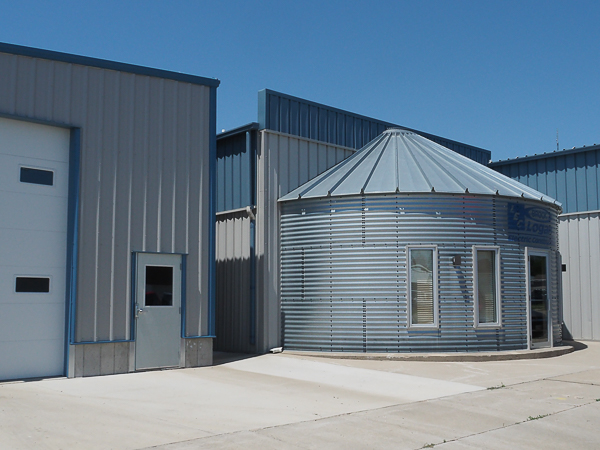
While most people spent time at the museum, I hoofed it downtown hoping to find a grocery store. We had run out of an essential nutrient: Lindt's 70% chocolate bars! I did find a store, but no Lindt 70% bars. On the way back I passed this electrical contractor's facility. We saw innumerable grain bins while passing through the fields and I was amused by this adaptation as an office.
As eccentric as the museum!
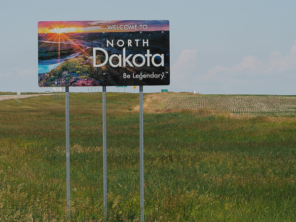
Not far from town, we entered North Dakota. I was not the only one marking this as my 50th state, so we stopped for a photo op.
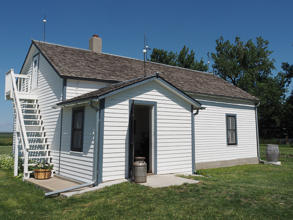
Our next stop was the Welk Homestead Historic Site. Son Lawrence Welk made the family name famous, but there was much more to the site.
This was the home to a family of eight. The boys slept upstairs and the daughters slept downstairs with their parents. It must have been cozy!
The farm was operated by the youngest Welk son until 1965.
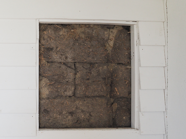
My notion of a prairie sod house is one that is dug out of the ground and roofed with sod. It had not occurred to me that someone might eventually cover the sod walls to protect them and put on a standard roof. In fact, those that have survived into the 21st century were so protected. Most of them used stucco on the exterior. This one used clapboard.
The museum has cut away some of the clapboard in a protected location under the entryway to show the original mud brick construction.
The interior walls were plastered, so there was nothing to distinguish this house from any other type of construction.
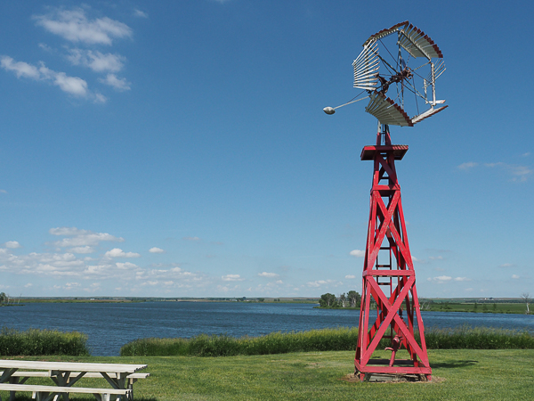
We saw a number of these odd-looking windmills in the Dakotas. When I asked our guide about them, he called them "box" windmills. That may be what he calls them, but I couldn't find that anyone else did.
After much surfing on the WWW I found that they are called "vaneless" windmills and this one is an example of a windmill made by the Dempster Mill Manufacturing Company. They are designed to face away from the wind and the folding sails enable the mill to accommodate varying wind speeds. When fully deployed the sails look very much like any other windmill. The company remained in business until 2009, but ceased making the vaneless type in 1941.
The lake is the background is Baumgartner Lake -- it has an extensive surface area, but is shallow.
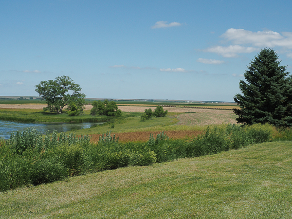
The parts of the Dakotas east of the Missouri River are the prototypical flat prairie. It was repeatedly glaciated during the ice ages.
Prior to the last ice age, all the rivers in the area flowed north into Canada. Glaciers dammed the ancient rivers forcing them into their current paths flowing south. The Red River of the North, which forms much of the border between Minnesota and North Dakota, is the only remaining north-flowing river in the area and one of only two in the US, the other being the St. Johns River in Florida.
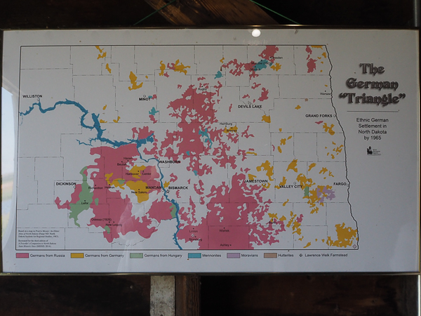
The Welk family was one of many German-speaking families that came to North Dakota in the late 19th century. This display shows their distribution. The pink color indicates German-speaking families that came from Russia (primarily Ukraine). Many fewer (yellow color) came from Germany and Hungary (green color).
Even smaller groups were German-speaking faith groups such as Mennonites, Moravians, and Hutterites (also from Russia).
Click your "back" button to return to the previous page or click for our picture album.