Jim and I have visited dunes in Arabia and Central Asia. Additionally I once visited dunes on Cape Cod. They are all different. We will never see the Oregon dunes the way they once were before human meddling. Plus Carol told us that we were not able to visit the largest and most impressive of the existing dunes on our trip because they were inaccessible. Nevertheless, those we saw were pretty impressive.
Actually, it is a misnomer to blame "human" meddling for the changes to the dunes. It should more accurately be "European" meddling. The Native Americans were much better at coexisting with their environment that we of European descent. Our "can do" attitude has a downside of acting without understanding the unintended consequences.
As Carol explained to us, once upon a time the Oregon Dunes were a wide-open, minimally vegetated area. (The detailed information at the link supports what Carol explained to us about the geology of the region.) The drifting sand made it difficult to build and maintain permanent roads or buildings. Although the first "roads" on the Oregon coast were actually the open beach, they were only accessible at low tide. Settlers introduced European beach grass, which has a massive root system, to stabilize the dunes. It worked wonders! The shifting dunes along the beach began to grow and a more-or-less massive and stable foredune was the result. Additionally, the new grasses introduced nutrients into the formerly sterile sand so shrubs and then trees were able to grow.
The coastal sand, being stabilized, is now unable to replenish the dunes behind the newly vegetated area, so a "deflation plain" results. The sand that does blow into this area is very light and fine, and thus highly erodible by the almost constant winds. Sometimes the sand is eroded right down to the water table resulting in fresh-water ponds or lakes. Behind the deflation plain other dune systems form along with "tree islands" in the sand.
All of this has had a major effect on native vegetation and animal habitat.
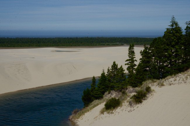
This picture shows the ocean in the far distance. The dunes along the beach are not visible because of the vegetation that has grown up behind them -- the dark band of trees and shrubs. The deflation plain is seen here as flat sand with ponds.
A tree island is next to the pond in the foreground.
Lynn told us that when he was growing up in Florence, he would set up camp with friends and family behind a tree island. They were protected from the winds and they had a beach right at hand!
These islands are remnants of older forest and they are populated with all the forest animals one would expect: bear, fox, cougar, etc.
But first, how did we get to the dunes?
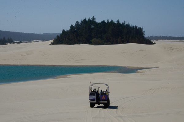
We loaded into two "dune coaches" run by Sand Dunes Frontier. In addition to our group, one of the coaches had a small group of Chinese tourists. Their leader translated everything Carol said about the dunes. (Carol said it was her first lecture in Mandarin.) The headsets provided by Road Scholar enabled us to hear (most of) Carol's comments even though we were in two vehicles.
Lynn had grown up with the operators of this business and even helped build one of their first dune coaches. I think we were riding in it!
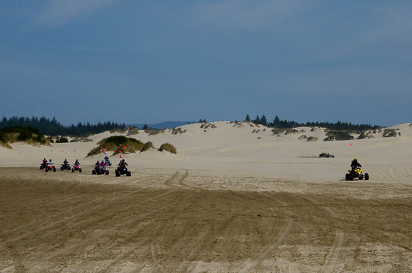
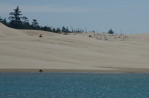
The deflation zone was a favorite race track for the dune buggies.
The expanse of the dunes has areas dedicated to various uses: (1) intensive recreational use, i.e., dune buggies, (2) passive recreation, e.g., camping, and (3) wilderness.
The intensive recreational use has been most effective at keeping out the invasive plants.
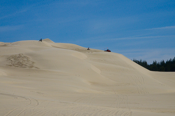
Although we didn't get to see the highest dunes, the ones we did see were substantial.
On our recent trip to the Gulf States of the Mid-East we had a couple of "dune bashing" excursions. Instead of dune buggies, however, we used Toyota Land Cruisers with professional drivers.
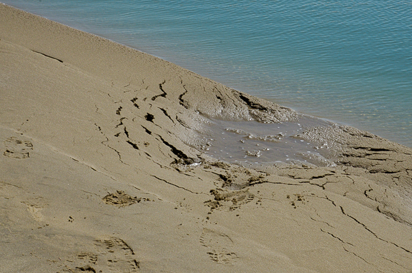
At one stop near a fresh-water pond, we were warned about the potential for quicksand.
We learned a new 75¢ word at this stop: thixotropic. The information at the link is pretty technical, which is to say I don't understand it.
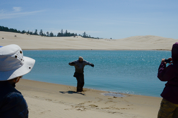
One of the buggy drivers illustrated how a walker can move from firm sand into quicksand abruptly. We were told that a driver giving a similar demonstration a week or two earlier sank much deeper and had to be pulled out by the spectators.
The sand was perfectly firm until it wasn't.
When I was growing up in Mississippi we used to take boats to the sandbars on the Mississippi River in the way that most people would go to the beach. Sandbars could have similar areas of quicksand. I've been tripped up by it more than once, but never in danger of getting "sucked in" like in the movies.
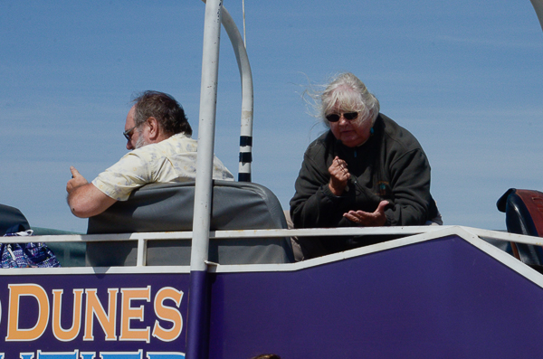
Lynn and Carol. Carol is earnestly explaining something or the other on the headset transmitter. Probably the meaning of thixotropic!
This is an example of a forest segment that had been buried by sand long enough to kill the trees before the sand eroded away again.
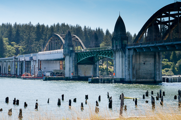
After our expedition in the dunes, we returned to the town of Florence for lunch and some time on our own. Jim and I ate lunch with Helene & Mel at the ICM Restaurant. It was yummy. After lunch we had some ice cream and walked down to get a picture of the Siuslaw River bridge.
The highway down the coast was first finished in the 1930s. It required several new bridges, funded through the Works Process Administration. Five of the bridges, including this one, were designed by Conde McCullough. Mr. McCullough aimed for beauty as well as function. This bridge certainly achieved that goal.
The bridge is currently being upgraded to meet stricter seismic standards.
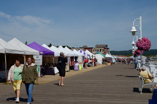
This was a Sunday and there was a market set up along the boardwalk. We didn't visit the various vendors but I know many in our group did.
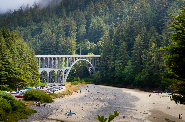
That afternoon we visited Heceta (heh-CEE-ta) Head. The Cape Creek bridge there was also designed by Conde McCullough. It is quite different but just as lovely as the bridge at Florence. This bridge reminded us of Roman aqueducts that we had seen in France on our trip there this past fall.
There is a lighthouse at Heceta Head. Click to read an extensive history of the place and the families that lived there (will open in a new tab).
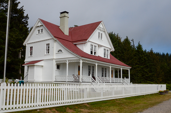
As we walked up to visit the lighthouse, we passed the lighthouse keeper's house. There were originally three keepers and two houses, but one of the houses was sold in 1940 with the proviso that it be demolished.
The remaining keeper's house is now a bed & breakfast.
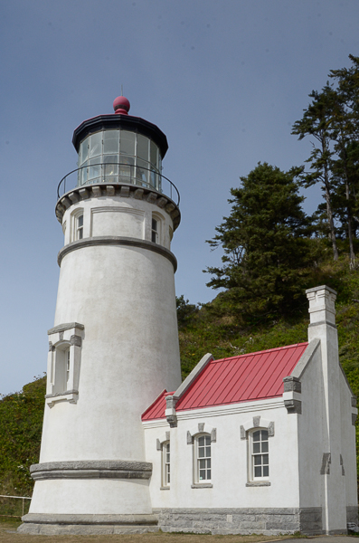
The lighthouse itself.
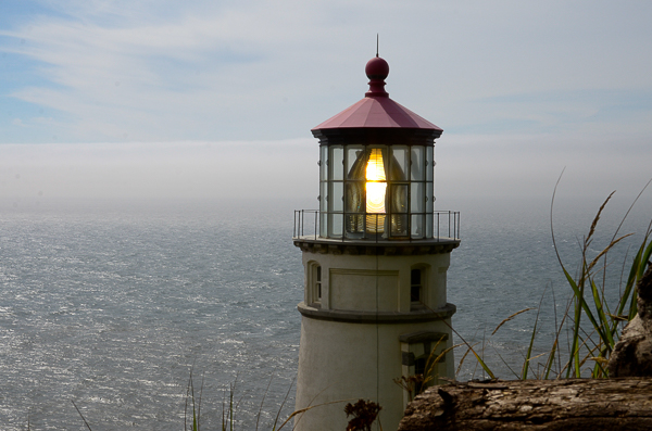
The lens of the lighthouse. It has a first-order (largest size) Fresnel lens.
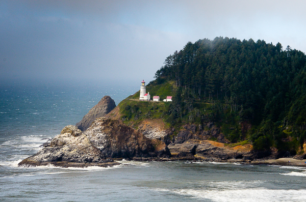
On our way back to the hotel for the evening, we pulled over at this viewpoint to get the full view of the lighthouse and the head. The keeper's house is out of the picture to the right.
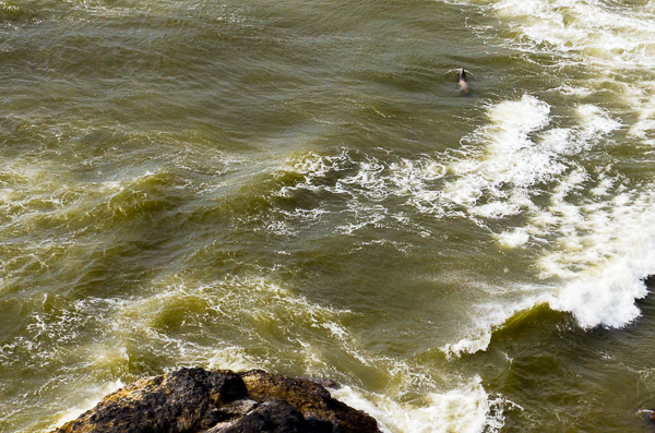
Also at the viewpoint we saw a seal -- or more probably a Steller Sea Lion. There is a nearby cave where they have been known to breed. The animal can be seen in the upper right corner of the image.
That was the end of the day's activities and we returned to our hotel. The next day we would leave early on our search for the eclipse!
Click your "back" button to return to the previous page or click for our picture album.