I never thought I'd be visiting my home town on a tour organized by the Smithsonian Institution, but in April, 2006, Jim and I did just that. The tour was led by Edwin Bearss, who had been the historian at the Vicksburg National Military Park when I was growing up. From the perspective of a "townie," he was much derided as he changed the park from our local thoroughfare and playground into a respectable place to interpret the military actions of the siege of Vicksburg. So my enthusiastic participation in the tour was somewhat ironic.
Our touring wasn't confined to Vicksburg. The campaign against it in 1863 included actions in Louisiana and surrounding communities in Mississippi. We visited many of the locations. The campaign was too complicated to cover in any detail here. I recommend the book Ninety-Eight Days by the late Warren Grabau. And then there is Mr. Bearss' own "Vicksburg trilogy:"
- Vicksburg is the Key, (Volume I of Vicksburg Campaign trilogy), 1985
- Grant Strikes a Fatal Blow, (Volume II), 1986
- Unvexed to the Sea, (Volume III), 1986
What follows is just a sampling of what we saw. It is ordered by the sequence in which we visited it, which was in general the sequence of the campaign.
Visit the American Battlefield Trust for a map showing an overview of the campaign and the places we visited. Highlighted on the map are engagements at Port Gibson, Raymond, Champion Hill, the Big Black river bridge, and Vicksburg itself.
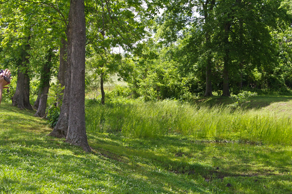
Prior to 1876 the Mississippi River flowed around an oxbow bend in front of Vicksburg. Confederate cannon on the high bluffs to the east controlled traffic on the river. The bend was so sharp that only a narrow neck of land was left between the upper and lower channels of the river.
General Grant put his troops to work digging a diversion across that neck on the Louisiana side of the river. It kept the troops occupied and, who knows, it might have worked.
This depression is what is left of their excavations.
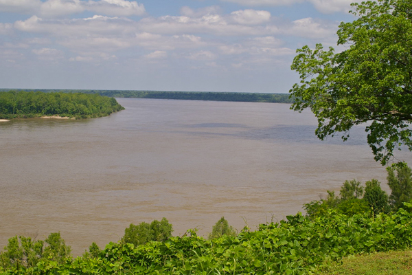 The
diversion didn't work, but in 1876 the river itself decided to cut off that
oxbow. Grant's canal is to the left of this view of the Mississippi
looking upstream from
South Fort. Vicksburg proper is
much farther to the right of this picture. Since 1876 the U.S. Army
Corps of Engineers have
dug a canal diverting the Yazoo River by the city enabling it to
remain a river port.
The
diversion didn't work, but in 1876 the river itself decided to cut off that
oxbow. Grant's canal is to the left of this view of the Mississippi
looking upstream from
South Fort. Vicksburg proper is
much farther to the right of this picture. Since 1876 the U.S. Army
Corps of Engineers have
dug a canal diverting the Yazoo River by the city enabling it to
remain a river port.This picture gives an indication of how the batteries on the Vicksburg bluffs could control shipping on the river.
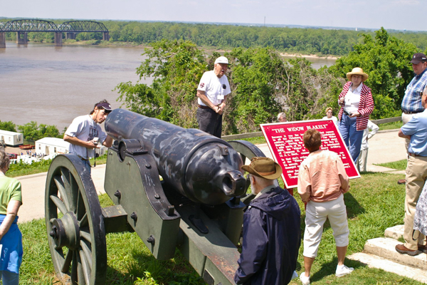 Although
most
of the batteries at Vicksburg today are reconstructions, this cannon was actually used
during the action - although not at this location. It is named
The Widow Blakely.
Although
most
of the batteries at Vicksburg today are reconstructions, this cannon was actually used
during the action - although not at this location. It is named
The Widow Blakely.The older river bridge can be seen in the background. It is not far from the location of Grant's canal.
Another famous gun used in the defense of Vicksburg was Whistling Dick, but it disappeared after the siege. (The photo at the link is identified by the Library of Congress as Whistling Dick, but there seems to be some controversy over that attribution. The nearby soldiers look like bluecoats to me!)
I remember Whistling Dick because we always bought our Christmas trees at its former location overlooking the former route of the Mississippi
 Grant
ferried his troops across the Mississippi south of Vicksburg near
Grand Gulf, MS.
His intent was to encircle the city and establish a siege.
Grant
ferried his troops across the Mississippi south of Vicksburg near
Grand Gulf, MS.
His intent was to encircle the city and establish a siege.This fortification was known as Fort Cobun. Since the Civil War the river's course has changed and the location no longer commands a view of the river. The river has eroded away most of the town.
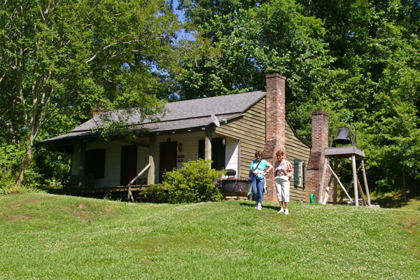 Only
two original houses remain of the town of Grand Gulf.
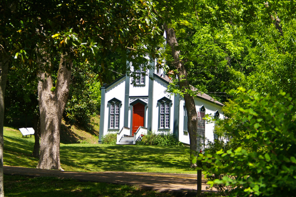 The
nearby town of
Rodney was left high and dry when the river moved away and is a ghost town today. We did not visit it on this tour.
The
Rodney Catholic church has been relocated to the Grand Gulf
park.
The
nearby town of
Rodney was left high and dry when the river moved away and is a ghost town today. We did not visit it on this tour.
The
Rodney Catholic church has been relocated to the Grand Gulf
park.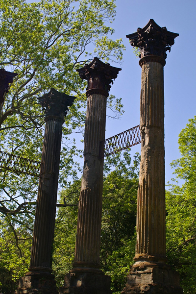 Windsor
plantation house survived the Civil War to burn in the late 19th
century. Only the huge columns remain. Hollywood came to the area
for location shots for the movie
Raintree County starring Elizabeth Taylor.
Windsor
plantation house survived the Civil War to burn in the late 19th
century. Only the huge columns remain. Hollywood came to the area
for location shots for the movie
Raintree County starring Elizabeth Taylor.When I was growing up, the ruins could be seen from a distance. Trees have grown up and now you must be practically inside to see them.
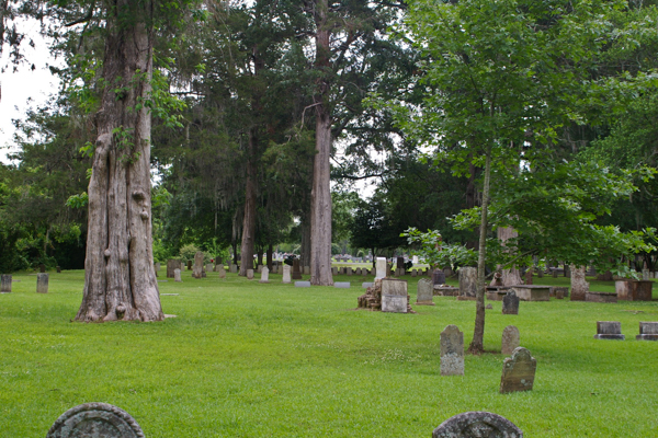 From
Grand Gulf, through the Romney area, to
Port Gibson
we followed Grant's march as he encircled Vicksburg.
From
Grand Gulf, through the Romney area, to
Port Gibson
we followed Grant's march as he encircled Vicksburg.There is a legend that Grant deemed Port Gibson "too beautiful to burn." Whether that is true or not, the town was not destroyed.
We visited Wintergreen Cemetery where Confederate dead are buried. The cemetery contains the grave of Maj. General Earl Van Dorn, killed not by Yankees but by a jealous husband!
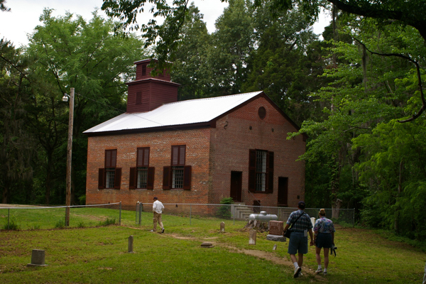 We
continued to follow in Grant's track up the Natchez
Trace toward Raymond. The army lingered near
Willow Springs
at Hankinson's Ferry on the Big Black River.
We
continued to follow in Grant's track up the Natchez
Trace toward Raymond. The army lingered near
Willow Springs
at Hankinson's Ferry on the Big Black River.By his actions in this area, Grant succeeded in isolating Vicksburg from the south.
Mr. Bearss pointed out that during the Civil War period and well into the 20th century these rural areas were densely populated. Nowadays most people have moved into towns and cities. The land is given over to enterprises like pulpwood production that are not as labor-intensive as cropping.
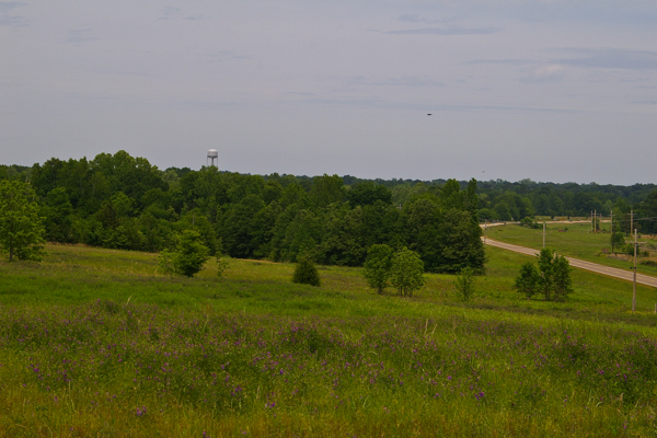 The
battle of Raymond was key
to isolating Vicksburg from the east. The Confederate forces had the
lower ground here as the Federal forces marched from the southwest.
The
battle of Raymond was key
to isolating Vicksburg from the east. The Confederate forces had the
lower ground here as the Federal forces marched from the southwest.The battle was a close one, but the federal forces carried the day.
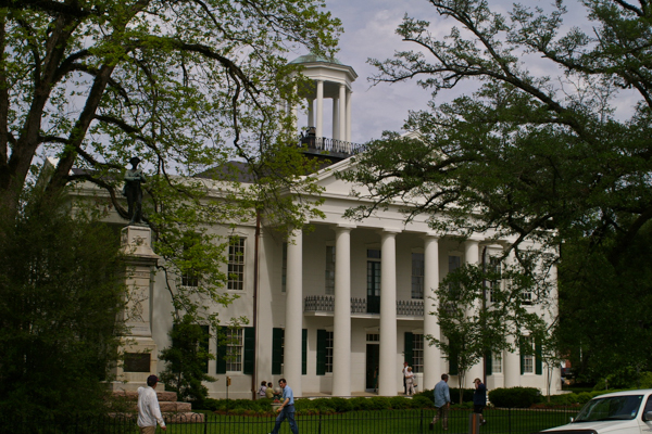 After
the battle, federal forces marched into the town of Raymond. The
ladies of the town had prepared a sumptuous spread for
the Confederates that they believed would win.
After
the battle, federal forces marched into the town of Raymond. The
ladies of the town had prepared a sumptuous spread for
the Confederates that they believed would win.The U.S. soldiers were happy to benefit!
A monument honoring the Confederates is located on the courthouse grounds.
From Raymond we traveled west to Champion Hill. This was the part of the tour that I had most anticipated and it was disappointing.
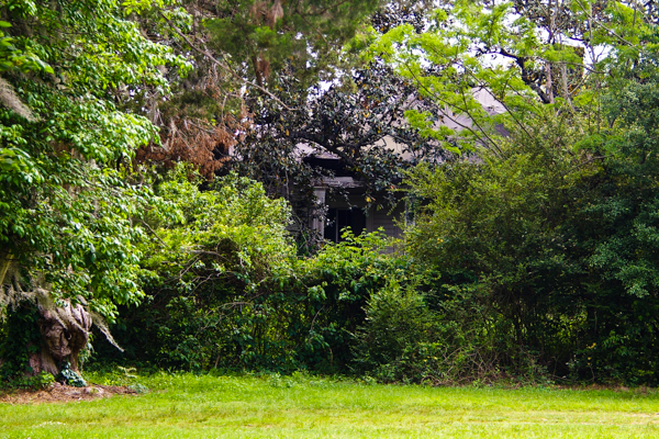
The battle of Champion Hill was chaotic and the physical landscape is still in private hands without any interpretation. The remains of the Coker House, shown here, are an indication of the physical state of everything we saw. In the years since, the Mississippi Department of Archives and History has acquired and restored the house, although it is not open to the public.
One benefit of putting together this narrative (in 2012, updated in 2019) is that I discovered a web site containing fascinating information about Champion Hill written by Mr. Bearss late wife, Margie, a noted historian in her own right. The vignettes at the link give life to the history.
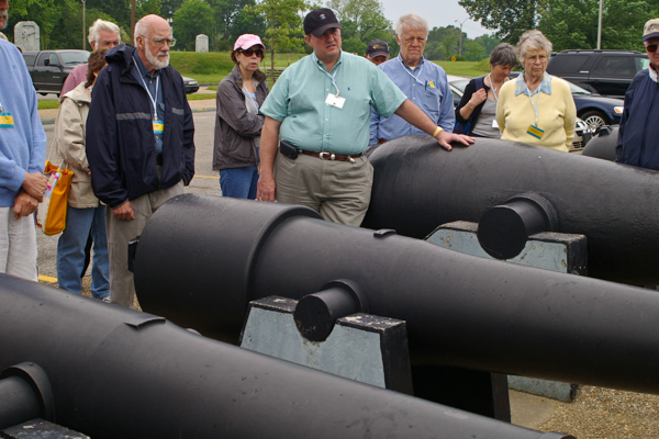 The
next day we toured the Battlefield Park at Vicksburg. At the park headquarters we visited
a display of the
many cannon types that were used in the action. Who knew there was
such a variety?
 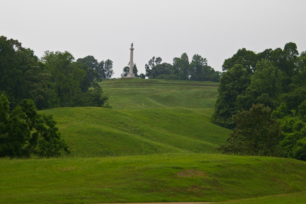 Vicksburg
sits on high
loess
bluffs overlooking the Mississippi basin. The city's defenses
were on high ground and difficult to take by force. The U.S. forces
tried more than once to storm the fortifications before they decided
to lay siege.
Vicksburg
sits on high
loess
bluffs overlooking the Mississippi basin. The city's defenses
were on high ground and difficult to take by force. The U.S. forces
tried more than once to storm the fortifications before they decided
to lay siege.Imagine what it must have been like to attack this position in the face, not only of fire, but also of a tangled abatis guarding approaches like this one. I can attest how hard it was to run up such an approach without any obstruction because my friends and I did it many times as children.
Large monuments honoring the states participating in the action are located throughout the park. They are generally located where their troops served.
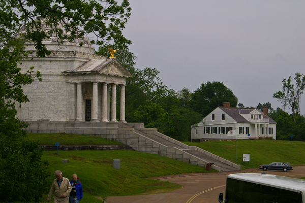 The
Shirley house on the right is the only structure within the Park's
boundaries that dates from the war.
The
Shirley house on the right is the only structure within the Park's
boundaries that dates from the war.The Illinois Monument is the grandest of the memorials within the park. I loved to visit it as a child because of the echo inside.
These are located on the "Graveyard Road" approach to Vicksburg, the site of the first frontal assault on the city. It failed with heavy losses. A second assault also failed. Grant and his army then settled in for an extended siege.
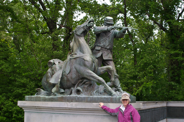 My favorite
sculpture when I was a child was at the Wisconsin Monument. I could scramble into the saddle of the
horse! Somehow I didn't realize that the horse portrayed was wounded
and probably dying. To me it was simply a chance to "ride."
My favorite
sculpture when I was a child was at the Wisconsin Monument. I could scramble into the saddle of the
horse! Somehow I didn't realize that the horse portrayed was wounded
and probably dying. To me it was simply a chance to "ride."The monuments in the park mostly date from the early 20th century, but at least one, the Kentucky Memorial, was dedicated in the 21st century. My maternal grandmother was from Kentucky. After she relocated to Mississippi she wanted to join the United Daughters of the Confederacy, but her father fought in the U.S. Army. Oops!
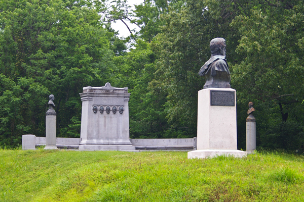 I'm
sure that every town has its location where young folks go to park.
Often these locations are the scenes of cautionary tales such as
the hook. In the days of my youth, Grant's headquarters
was THAT location. We called it "five faces" because of the
sculptures shown here.
I'm
sure that every town has its location where young folks go to park.
Often these locations are the scenes of cautionary tales such as
the hook. In the days of my youth, Grant's headquarters
was THAT location. We called it "five faces" because of the
sculptures shown here.Nowadays admission to the park is limited and it is not open after dark. Ed Bearss was one of the driving forces behind that change. It didn't make him popular in Vicksburg.
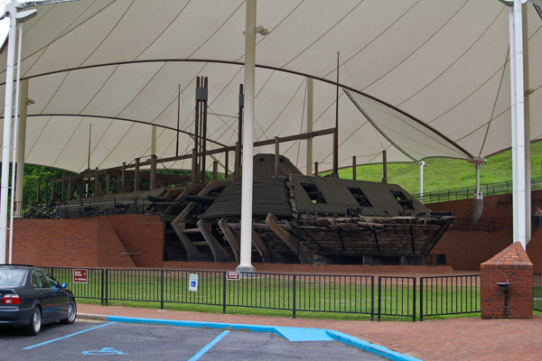 In
the mid-1950s Ed, Warren Grabau (the father of my best friend growing
up), and Don Jacks did extensive research and exploration to locate the
resting place of the
USS Cairo,
the first ship in history to be sunk by an electrically detonated torpedo.
In
the mid-1950s Ed, Warren Grabau (the father of my best friend growing
up), and Don Jacks did extensive research and exploration to locate the
resting place of the
USS Cairo,
the first ship in history to be sunk by an electrically detonated torpedo.Local residents became enthralled in the discovery of the ship and the attempts to salvage and preserve it. Numerous difficulties, including the death of a prominent local doctor, had to be overcome before the ship could be raised (in pieces) in 1965. A teaser video on YouTube introduces the story. A 2019 presentation by Ed on the raising of this vessel gives insight into the difficulties -- and his delivery, which hasn't changed since we were on this trip. It is a one hour video (with slides) and opens in a new tab. He is 96 when giving this presentation and gets his dates mixed up, but not his stories! My friend's dad is the unnamed geologist. An archive of papers (opens in new tab) at the Yazoo City Library has more information than you ever wanted to know about the Cairo -- including how to build one just like it!
Many artifacts were discovered and the Park Service constructed a museum to house and interpret them.
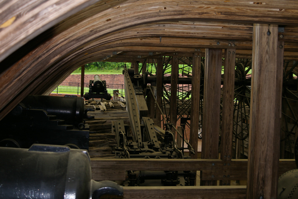 Funding
and technical delays almost resulted in the loss of the ship itself
until the preserved remains were finally conserved beside the museum housing
the contents.
Funding
and technical delays almost resulted in the loss of the ship itself
until the preserved remains were finally conserved beside the museum housing
the contents.Although the metal parts, the iron cladding, the cannon, and the engines were saved, the picture shows that very little of the wooden structure was salvaged. Almost all the wood pictured is reproduction.
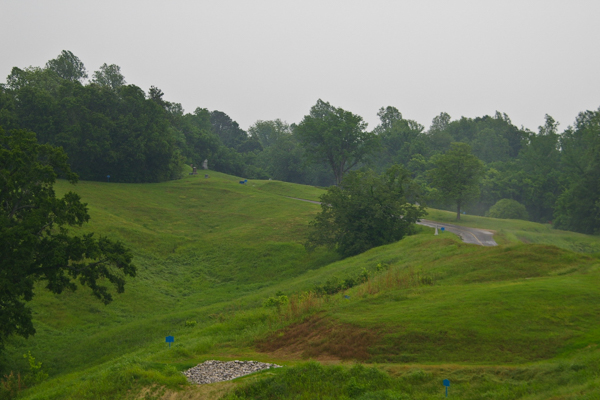 Our
final stop after visiting the Cairo museum was the location of the meeting
between Generals Grant and Pemberton for the final
surrender
of Vicksburg after a long and brutal siege. General Pemberton may
have chosen July 4 for the surrender date in hopes of getting more
lenient terms. The unintended consequence was that Independence Day
was
not celebrated in Vicksburg for many years! As William Faulkner,
a Mississippian,
wrote:
The past is not dead. It's not even past.
 By the time we got there a thunderstorm had moved in. Pouring rain and intermittent lightning resulted. Most of our group slogged out with Ed to hear details of the surrender, but Jim and I didn't think it was a great idea to be standing in the storm holding a dandy lightening rod disguised as an umbrella.
We were quite satisfied with our decision to visit my home town as tourists!
Click your "back" button to return to the previous page or click for our picture album.